


Boreholes app for iPhone and iPad
Developer: NEXT Environmental Inc.
First release : 15 Oct 2012
App size: 16.37 Mb
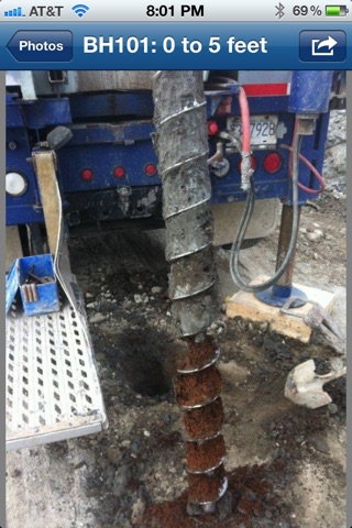
In the Environmental Consulting industry, a photograph is generally taken of the soil column to supplement field notes during drilling investigations. Unfortunately, there was never a good way to take photographs of largely indistinguishable auger flights and easily catalouge them when downloading the photographs - until now!
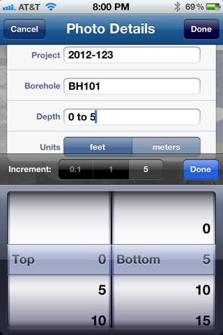
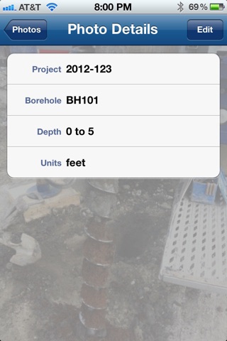
NEXT Environmental Inc. has created BOREHOLES, an App which allows you to name in-field photographs of auger flights based on project number, borehole name, and depth range. For each subsequent photograph, the project number and borehole name will be repeated (and can be edited), allowing for the quick naming of photos. The depth range will automatically increase to the next increment (set as 0.1, 1, or 5), which can be changed from ft to m.
While in the field, each photograph can be edited if need be. The handy display always lists photos in varying cyan color scales with depth for visual ease. It also organizes the photographs by project number, borehole, and depth range so that you can always find the exact photo you are looking for, which is particularly handy when comparing similar geological units and depths in the field.
When ready to download the photos, plug your device into your computer and open iTunes. Click on the App tab and select the BOREHOLES App. There you can download all your photographs into their specific project folders. The name of each photograph will be named by the project number, borehole name, and depth range (e.g., 2012-123_BH101_0-5ft.jpg) for easy retrieval.
This App can work with solid stem auger, split spoon, and sonic drilling techniques just to name a few.
Happy Drilling!!!